Cacadu District Municipality (Sarah Baartman District Municipality)
Sarah Baartman District Municipality (formerly Cacadu District Municipality) is situated in the western part of the Eastern Cape province, covering an area of 58 242 square kilometres. The area of the district municipality includes seven local municipalities. The seat of Sarah Baartman is the city of Gqeberha, although Gqeberha is not itself in the district (it is in the Nelson Mandela Bay Metropolitan Municipality). The languages most spoken among the 388,201 people are Xhosa and Afrikaans (2001 Census). The district code is DC10.
The municipality is a multi-ethnic administration, formed by the ANC government through the merging of the predominantly Afrikaans-speaking western part of the Eastern Cape, together with Xhosa areas near the Fish river, and the English district of Albany (with its own distinctive local culture, dating back to the 1820 settlers).
The name Cacadu is regarded by the Xhosa as covering the entire area of the district municipality, but in fact it is taken from a river that runs entirely in Gqeberha. Cacadu, meaning "bulrush water", is the Xhosa form of the Khoekhoe name of the river. The Dutch name is a translation: Papenkuils (in modern Afrikaans a bulrush is called a papkuil). The river rises in the Parsons Vlei and runs to the sea close to the Gqeberha industrial suburb of Deal Party.
In 2015, Cacadu District was renamed for Saartjie "Sarah" Baartman (1789–1815), a Khoikhoi woman who was taken to London to perform at freak shows and after her death her remains were exhibited until 1974. The renaming is part of an effort to redress marginalisation of the Khoikhoi people.
The Executive Mayor of Sarah Baartman District Municipality is Khunjuzwa Eunice Kekana, and the Municipal Manager is Ted Pillay.
Map - Cacadu District Municipality (Sarah Baartman District Municipality)
Map


Country - South_Africa
 |
 |
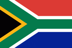
| Flag of South Africa | |
About 80% of the population are Black South Africans. The remaining population consists of Africa's largest communities of European (White South Africans), Asian (Indian South Africans and Chinese South Africans), and multiracial (Coloured South Africans) ancestry. South Africa is a multiethnic society encompassing a wide variety of cultures, languages, and religions. Its pluralistic makeup is reflected in the constitution's recognition of 11 official languages, the fourth-highest number in the world. According to the 2011 census, the two most spoken first languages are Zulu (22.7%) and Xhosa (16.0%). The two next ones are of European origin: Afrikaans (13.5%) developed from Dutch and serves as the first language of most Coloured and White South Africans; English (9.6%) reflects the legacy of British colonialism and is commonly used in public and commercial life.
Currency / Language
| ISO | Currency | Symbol | Significant figures |
|---|---|---|---|
| ZAR | South African rand | Rs | 2 |
| ISO | Language |
|---|---|
| AF | Afrikaans language |
| EN | English language |
| ST | Sotho language |
| SS | Swati language |
| TS | Tsonga language |
| TN | Tswana language |
| VE | Venda language |
| XH | Xhosa language |
| ZU | Zulu language |


